
Tawnaghmore [An Tamhnach Mhor]
Good walks are even better shared.
Overview
Tawnaghmore [An Tamhnach Mhor]
Welcome to Tawnaghmore, a delightful spot for hiking enthusiasts and nature lovers alike. Standing tall at 483 meters, this Marilyn offers a moderate challenge with bountiful rewards for those who make the trek.
Geology
Tawnaghmore showcases a picturesque landscape primarily composed of limestone and sandstone. As you ascend, keep an eye out for fascinating karst formations that tell a geological story of ages past. The summit, with its weathered rocks, invites you to pause and reflect—preferably without tripping over your own boots!
Routes
The most popular route begins from Fivemiletown, a quaint village where you can snag a scone for the journey. The Tawnaghmore Trail stretches for approximately 7.5 km round trip, maintaining a moderate difficulty level that’s perfect for keen hikers. Expect to take about 3.5 hours to complete the hike, including photo stops—because let’s face it, the views are Instagram-worthy!
Summit Features
Once you reach the summit, you’ll find a charming stone cairn marking the highest point, along with a grassy plateau that’s perfect for a well-deserved picnic. Birds often soar overhead, perhaps checking you out as you do your best mountaineer pose.
Terrain Type
The terrain varies from grassy paths to rocky outcrops, with a few boggy patches thrown in for good measure. The bogginess can add an element of fun—if by fun, you mean mud splatters all over your gear!
Views
From the summit, you’ll feast your eyes on breathtaking panoramas of the Fermanagh lakes and the rolling green hills that define this beautiful part of Northern Ireland. For the best visibility, aim for late spring or early autumn when the foliage is vibrant and the skies are clear.
Hazards
As with any outdoor adventure, be mindful of potential hazards. Slippery slopes can be tricky during wet weather, and remember to avoid those enticing bogs that seem like a comfortable resting spot—trust us, they aren’t!
Access
Accessing Tawnaghmore is straightforward. Park in the lay-by on the B4 road near Fivemiletown and check local bus schedules if public transport is your jam.
Facilities
While Fivemiletown offers a few cafes and shops, do yourself a favour and pack some snacks and water—your tummy will thank you later!
History
As you explore, remember that Tawnaghmore’s name means 'the great meadow'. It’s reflective of the region’s pastoral beauty. With no significant historical battles fought here, the area is rich in local lore and tradition, perfect for sharing stories over a cup of tea after your hike.
Now lace up those boots, grab that walking stick, and get ready to explore the magnificent Tawnaghmore—the great meadow awaits!
Explore routes near Tawnaghmore [An Tamhnach Mhor]
Public walks starting within 80 km of this hill. Nearby does not mean a route reaches the summit; check its map and access before setting out.
No public routes are currently listed within 80 km of Tawnaghmore [An Tamhnach Mhor] on Walkmates. This does not mean there are no paths here. Explore the map and check local access information before planning a walk.
Route planning notes
These notes describe possible approaches, not verified navigable routes or permission to cross land. Check current paths, local access rules and conditions before setting out.
Tawnaghmore Trail from Fivemiletown
A scenic route suitable for moderate hikers, beginning in the village of Fivemiletown and winding through lush countryside before ascending the mountain.
Make a day of it, together
Find someone to share the walk with, or organise a day out along a route you like.
Hill facts and local notes
Classifications
Elevation
340m
1,115 ft
Prominence
284m
Coordinates
54.2937, -9.5995
F959395
OS Map
23
At the Summit
The summit features a well-defined grassy plateau with a small stone cairn marking the highest point. On a clear day, the view from the top is simply magnificent.
Terrain & Geology
Tawnaghmore is primarily composed of limestone and sandstone, features characteristic of the geology in County Fermanagh. The summit area is marked by weathered rock outcrops and interesting karst formations.
Views & Scenery
From the summit, hikers are treated to expansive views of the surrounding countryside, including the stunning Fermanagh lakes and distant hills.
History & Heritage
Name Origin
The name 'An Tamhnach Mhor' translates to 'the great meadow', reflecting the lush pastures of the surrounding area.
Historical Significance
While not steeped in grand historical events, the region is rich in folklore and traditional stories, often shared over a cup of tea by the locals.
Getting There & Facilities
Check current local access restrictions, parking rules and transport timetables before travelling. These notes do not confirm public access to the summit.
Parking
There is a small lay-by on the B4 road just south of Fivemiletown, which can accommodate several cars.
Public Transport
Buses operate regularly from nearby towns like Enniskillen and Omagh, with the closest bus stop in Fivemiletown.
Nearby Facilities
The village of Fivemiletown has a few cafes and shops, but it's wise to pack your own snacks and water to avoid any mid-hike hunger pangs.
Safety Information
Known Hazards
- Beware of slippery slopes during wet weather, and the occasional boggy patch could leave you feeling more like a swamp creature than a hiker.
General Safety Tips
- Check weather conditions before setting out
- Carry appropriate clothing and equipment
- Let someone know your planned route
- Take a map, compass, and GPS device
- Carry emergency supplies: food, water, first aid kit, torch
Hills
Some common questions about the hills answered
Are there group walks up Tawnaghmore [An Tamhnach Mhor]?
Many walkers use Walkmates to join or organise walks with others. You can check for group walks around Tawnaghmore [An Tamhnach Mhor] through the maps
Are there other walkers around Tawnaghmore [An Tamhnach Mhor]?
Activity varies by location and time, but Walkmates lets you see whether others have shared walks or shown interest in this area. Find other people through the walking friends search walking friends for Tawnaghmore [An Tamhnach Mhor] search or of course create your own walk for Tawnaghmore [An Tamhnach Mhor]
Can I organise a walk to Tawnaghmore [An Tamhnach Mhor]?
Yes. If there aren’t any walks listed already, you can create a walk and make it available for others to join.
If you're signed up to Walkmates, you can create a walk to Tawnaghmore [An Tamhnach Mhor].
How do I find a walk up this hill?
There are often multiple ways to walk this hill, depending on experience and route preference. Walkmates helps you explore walks and routes that others have shared.
Can I suggest a new route up Tawnaghmore [An Tamhnach Mhor]?
Yes. You can suggest or create routes to share with others. Walkmates focuses on the social side of walking, so routes are used to help people organise walks and explore areas together, rather than as detailed navigation tools or route libraries.
Other uses really appreciate knowledgeable walkers sharing their routes. Share your favourite route to Tawnaghmore [An Tamhnach Mhor] here
The is an error or something incorrect about this hill. How do I let you know?
We always strive to keep the information on Walkmates as accurate as possible. If you find an error, please let us know through the contact form and we'll aim to correct it as quickly as possible
Community Discussion
Comments
Location
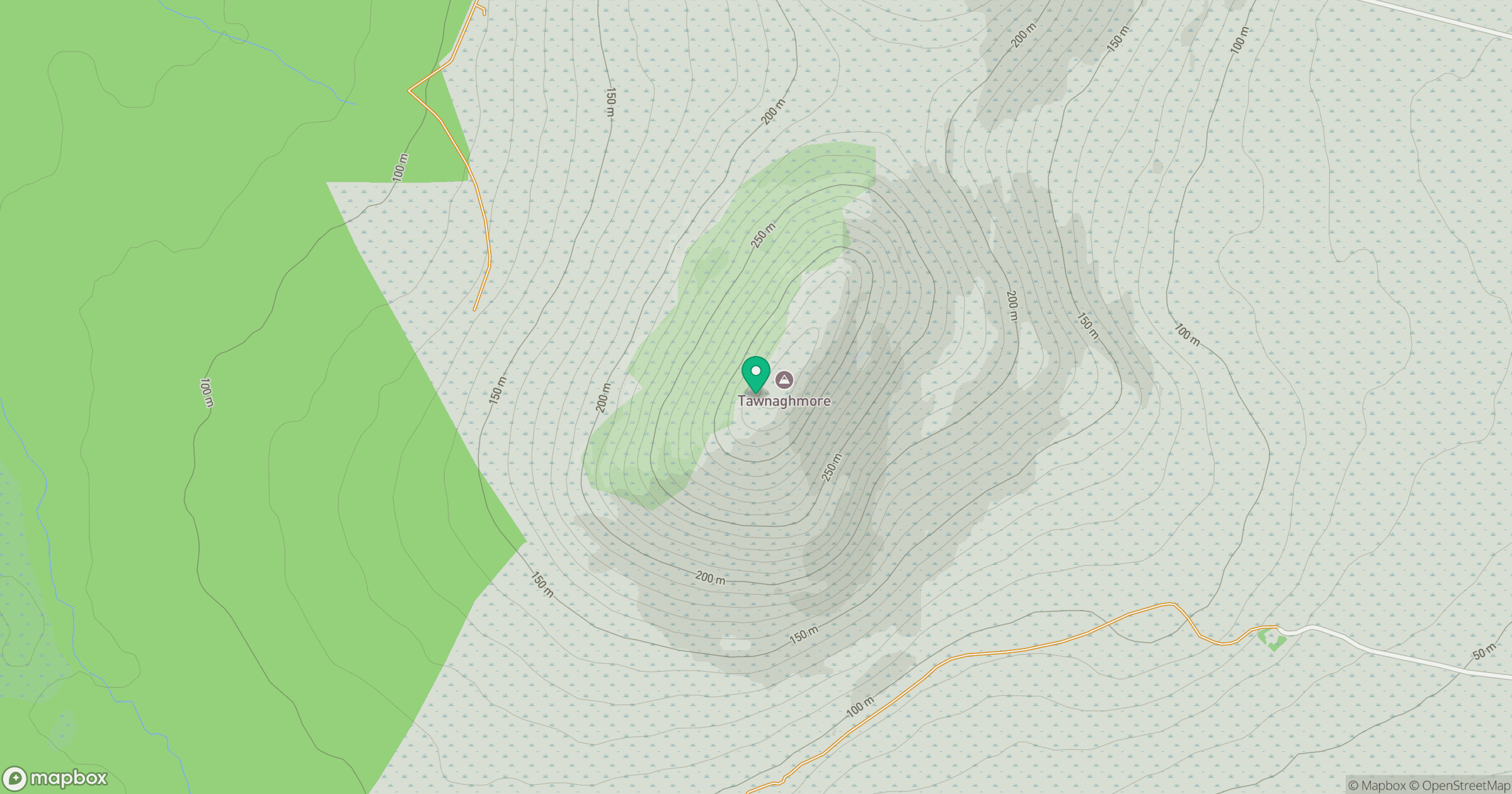
Grid reference: F959395
View on OpenStreetMapOpens a map in a new tab, centred on the hill.
Hills within 30 km
Straight-line distance, not a walking route or confirmation of access.
No comments yet. Be the first.